Total Miles Traveled 1448
We have purchased a handheld satellite communicator that
allows us to stay connected anywhere we cruise.
If we are out of cell phone or VHF radio range and we have an emergency,
we can send a distress signal for assistance; the communicator also tracks our
location and can be configured to track our location between 2 minutes and 4
hours. We purchased the communicator as
an additional safety device while cruising but an added feature is MapShare. MapShare provides family and friends a way to
see where we are while cruising by going to our web page and viewing a map and
our track. Here is the link to our
site:
https://share.garmin.com/RickVicars The site is currently set up for viewing our
track only, and does not permit visitors to send messages or request our
current location.
We arrived at Ft Myers January 5th; we had a
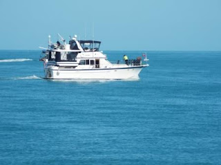
beautiful day of cruising with the temperature around 80 and calm winds. We passed the boat "Avocet" that we met in New York last year, they snapped this picture of us crossing Pine Island Sound.
We spent Friday with friends that are snowbirds
from back home; we had lunch at the Ford Garage a few blocks from the marina,
and had a great visit with them.
We were glad to be in the Okeechobee Waterway as a cold
front moved in Saturday morning bringing thunderstorms and high winds. A small craft advisory was in effect for
Saturday and Sunday so we stayed tied to the dock for the weekend.
We left Ft Myers Monday morning January 9th
and headed east on the waterway, it was still windy but the Okeechobee Waterway
is basically a narrow canal preventing the waves to build as it does on the
open waters. We stopped by a looper friend’s
house “Miss My Money” located on the waterway only a few miles from Ft
Myers. Looks like a nice place to visit
on the way back home…if their not away cruising. We
continued east along the waterway, the scenery is quite different than the
coastal waters of the Gulf.
We arrived at La Belle Florida Monday afternoon; the city
provides several free docks with water and electric. We walked to town, picked
up a few things at the Dollar General, and stopped at the Forrey Grill for
dinner, what a great stop along the waterway.
After cruising a few miles Tuesday morning, we noticed
two boats coming up behind us. One of
them was a boat we met at Waterford, NY “Willy Nilly III” during our loop. They took the Erie Canal route and we took the
Lake Champlain route and didn’t see each other again until today. We were both heading to Clewiston, Fl so we
traveled together the rest of the day.
We had planned to visit the Roland Martin Marina at Clewiston but were
told by the marina that the lock was closed for two days and access to the
marina would not be possible. We spent
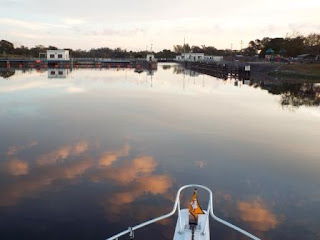
the night on the waterway tied between two dolphins (pilings) with one line
connected to the bow and the other to the stern.
Today we crossed Lake Okeechobee; we left at daybreak to
get across before the wind kicked the waves up making a bumpy ride. Photo courtesy of Willy Nilly III
“Willy Nilly III” following us across and the birds
looking for breakfast in our wake.
The lake water is much different than what we have seen
in our travels. We didn't see a depth of over 15 feet during our crossing.
After crossing the lake, the lock doors were open
allowing us to pass through at an idle.
A short distance past the lock was an open railroad swing bridge with a
6 ft clearance. We approached very
slowly and could not see a light or any type of building to communicate with so
we proceeded slowly through the opening.
After passing through I looked back and saw the swing bridge closing so
we are assuming the lockmaster could see the bridge and that we were clear.
We
arrived at the St Lucie Lock this afternoon, there are only 8 slips here and
our reservation isn’t until Friday so we anchored across from the marina and
campground. While enjoying the view we
saw an alligator swimming across the waterway about 200 feet from the boat,
couldn’t get Moni in the dinghy to visit Willy Nilly at the docks : (


